Floodplain Info
Learn More
 The Official Web Site of the State of South Carolina
Sign up for Everbridge, the Town’s Emergency Notification System, to receive emergency texts and emails, and the Town's Monthly Newsletter to stay up to date on all of Town's meetings, projects and special events.
Stormwater Master Plan- Final Draft by Seamon Whiteside Associates
Historic Design Guideline presentation postponed. Click here for more information.
Final Council Presentation to March 18, 2025- 6:00pm
Please join the Town of Sullivan’s Island and Seamon Whiteside Associates on March 18, 2025 for a Town Council presentation of the Island’s Stormwater Master Plan.
Open House- October 15, 2024- 5:00 p.m. to 6:00 p.m. Council Presentation- 6:00 p.m.
Please join the Town of Sullivan’s Island and Seamon Whiteside Associates for an open house and Town Council presentation of the Island’s Stormwater Master Plan.
Town staff and the Town’s engineering consultants will be on hand to answer any questions on stormwater issues and discuss the various elements of the Stormwater Master Plan, along with an overview of various Island-wide stormwater improvements (SCIIP grant). We look forward to hearing your input!
Stormwater Master Plan Open House & Town Council Presentation
March 19, 2024 5:00pm-7:00pm
Project Summary:
Seamon Whiteside and Associates (SW+’s) has been contracted to develop a resilient and comprehensive drainage infrastructure improvement strategy. The intent of this study will be to complete a holistic investigation of the entire island (including the SCIIP and HMGP project areas) to provide an understanding of existing flood conditions, develop solutions to mitigate existing flood conditions, and provide conceptual designs to springboard project implementation once funding becomes available. Based on understanding the Town’s needs, the following sections outline SW+’s approach to providing a cost-effective and scientific, yet constructable solution.
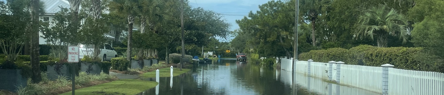
Sullivan’s Island is a low-lying barrier island that is mostly residential in nature but serves as a recreational haven for tourists and neighboring communities. This unique coastal community is full of history and has done a great job at preserving an outstanding quality of life. However, extreme flood events and aging drainage infrastructure are beginning to create challenges in maintaining and achieving long-term coastal resiliency. As a result, this project is critical for holistically investigating drainage deficiencies and developing a sound comprehensive strategy to address flooding experienced today while also preparing for tomorrow’s changing coastal environment.
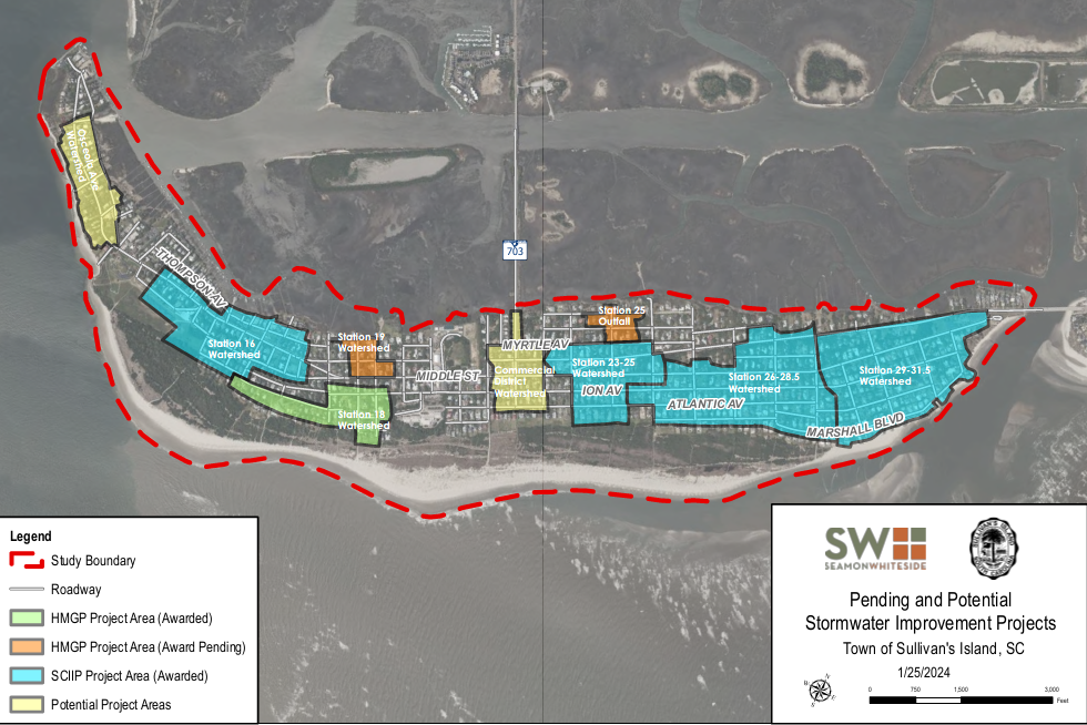
Pending and Potential Stormwater Improvement Project Map
Click on the image below for an interactive map of pending and potential stormwater improvement projects. For the non-interactive PDF version please click here.
A considerable portion of the island has existing drainage infrastructure, much of which was installed by the South Carolina Department of Transportation SCDOT). Rather than discounting these systems with a full-blown replacement, which can be costly and burdensome on the community, there may be cost-effective maintenance and/or retrofit solutions that should be explored. Such solutions, as well as new drainage systems in areas without any drainage systems, can be explored with town staff and community members to identify the best and most viable long-term solutions for the community. This is the crowning goal of this project; finding the best and most cost-effective solutions that will enable Sullivan’s Island to continue thriving for hundreds of years to come.
A primary challenge faced by the Town’s staff is addressing regular complaints related to nuisance stormwater-related flooding within conveyance systems owned and maintained by the South Carolina Department of Transportation (SCDOT). The Island’s drainage system is comprised of a mix of open ditches and closed pipe drainage systems owned by SCDOT with all administrative functions related to NPDES 2 (DHEC permitting) overseen by the Charleston County Stormwater Management Program. Heavy rainfall events, extreme high tides, sea level rise, high water table, and coastal storms, combined with inadequately sized and poorly maintained infrastructure, creates flooding conditions throughout the Island. The impacts of this flooding include:
The Town’s engineering consultant, Seamon Whiteside and Associates (SW+’s), will develop the stormwater master plan in phases by systemically inspecting and cataloging existing drainage infrastructure, leveraging innovative technologies, and welcoming resident feedback while developing a hydrologic and hydraulic model which can be used to identify drainage system deficiencies and coastal food risk.
Upon completion, a report detailing the process and results of the stormwater master plan will be delivered to the Town along with any supporting data. This final report (or plan) will serve as a foundation for the Town to move forward with pursuit of project funding, engineering design, permitting, and construction. The project will generally follow the phases noted below:
Phase 1 – Data Gathering:
Phase 2 – Analysis:
Phase 3 – Alternative Analysis and Findings:
Phase 4 – Project Recommendations: