The Official Web Site of the State of South Carolina

Click Here to review our Stormwater Master Plan Page.

Join our Arbor Day Celebration! Click Here for More Information!


Council has recently tasked Thomas and Hutton with exploring additional recreation concepts for the Stith Park Master Plan which could further enhance the Park experience.  To gather additional information, the engineer has been asked to delay the presentation scheduled for April 16, 2024 to a later to be determined date. Appropriate notification will be provided for the rescheduled presentation date.


Hurricane Idalia Heavy Weather Warning

Tue, 08/29/2023

                                       Hurricane Idalia

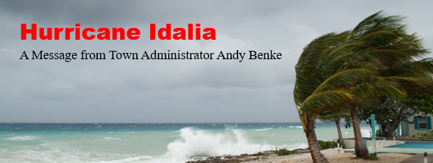
Good morning Island residents,

By now I hope you have begun to follow the track of Hurricane Idalia.  Town staff in finalizing its preparations to make the Island ready for the arrival of storm conditions as early as mid-morning Wednesday 8-30-23. Staff has been participating in various meetings with its federal, state, county, and municipal disaster preparation partners for this weather event. Below you will find key information regarding the storm and what to anticipate during the next few days.  More messages will follow but you should also monitor the National Weather Service and your local media for information as well.  

  • Storm Position, Strength, and Movement – At 7:00AM the National Hurricane Center Advisory 11A reported the location Hurricane Idalia at 23.8N 84.8W which is about 135 miles WSW of the Dry Tortugas or 590 miles from Sullivan’s Island.  NOAA Hurricane Hunter aircraft find that the storm is strengthening. Maximum sustained winds 80 MPH, central pressure 28.85 inches with North movement at 14MPH. There is presently a Tropical Storm Watch in effect for Lower Florida Keys to the South Santee River. A Tropical Storm Watch means that tropical storm conditions are possible within the area generally within 48 hours.
  • At this time there is high confidence that the storm will downgrade from a hurricane to a tropical storm once making landfall along the west coast of Florida.  It should move rapidly through Florida, Georgia and South Carolina. There is less confidence of the track through South Carolina.  However, storm conditions are expected as early as Wednesday mid-morning with the peak event occurring between 6pm Wednesday and 2am Thursday. Maximum sustained winds are expected to peak at 50mph with gusts up to 60mph. Heavy rain and tide surge is anticipated to be associated with the storm event.


For now residents should consider:

  • Reviewing your family hurricane plan
  • Closely monitor local media coverage for the latest information on the storm location and intensity
  • Expect a considerable amount of rain on top of a tide surge estimated to be 2ft to 4 ft
  • If you have a boat alongside check your mooring lines and bilge pumps
  • Secure any outside furniture or plants that could become projectiles as the wind increases
  • Fill your underground propane tanks for use in the event of a power failure and to prevent the tank for surfacing from below ground
  • In the event you lose power contact Dominion Energy at 1-888-333-4465; you can also view the Dominion Power Outage Map at https://outagemap.dominionenergysc.com
  • Never approach a downed power line as it or the ground around it can be energized
  • Review Charleston County's bridge procedures during high winds

What the Town staff is doing in the next 36 hours

  • While the Town remains at OPCON Level 3 and staff is standing by at the ready, initial hurricane plans have been put into operation
  • Town staff participates daily with Charleston County Emergency Management Department and other federal, state and local agencies to prepare for any adverse weather conditions
  • As of now garbage collection will occur today and Friday 9-1-23
  • Town Hall will remain at normal operations through 12pm Wednesday 8-30-23
  • Damage assessments will be on the Island early Thursday 8-31-23
  • The Town will email storm updates as available


Please stay tuned for further updates.

Regards,

Andy Benke
Town Administrator
Town of Sullivan's Island
Post Office Box 427
Sullivan's Island, SC  29482
Direct Telephone: 843-883-5726
Facsimile: 843-883-3009
Emergency: 9-1-1
Police and Fire Dispatcher: 843-743-7200
Email address: abenke@sullivansisland.sc.gov