Floodplain Info
Learn More
 The Official Web Site of the State of South Carolina
Sign up for Everbridge, the Town’s Emergency Notification System, to receive emergency texts and emails, and the Town's Monthly Newsletter to stay up to date on all of Town's meetings, projects and special events.
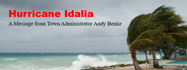

Greetings Island residents,
Based on the 3:30PM conference call with Charleston County Emergency Management and the other state and municipal partners there has been little change to the information provided earlier. Below are a few highlights and updates of the discussion:
Storm Position and Strength – At 2pm today Hurricane Idalia is located at 25.2N 84.9W or 130 miles WNW of the Dry Tortugas and approximately 519 miles SW of Sullivan’s Island. The category 1 storm has maximum sustained winds of 90 MPH with minimum central pressure of 28.76 inches. The storm is expected to intensify before making landfall on the west coast of Florida. After landfall, the storm will likely downgrade back to tropical storm level and travel north through Georgia and South Carolina. The tropical storm watch has been extended from the lower Florida Keys to Surf City, North Carolina (previously South Santee River in Charleston County). A tropical storm watch means tropical storm conditions are possible within the watch area, generally within 48 hours.
The earliest that Sullivan’s Island should begin to experience storm conditions would be Wednesday 8-30-23 at 10am to Noon. The duration of the tropical storm conditions is currently expected to be between 6pm Wednesday to 2am Thursday. There is high confidence for tidal flooding in low lying areas of Sullivan’s Island with a forecast flood slack water at 8.3 feet (2 ft of surge on top of the astronomical tide height). Rain fall is expected to be in the 1-inch to 3-inch range with most rain bands passing to the west of Charleston County.
Tide sequence for Wednesday and Thursday:
Sand bags are available at the Sullivan’s Island Fire Station. Sand is available at Quarter Street.
Items for you to consider:
Other information:
I anticipate another weather message tomorrow morning after the 8:30am call with Charleston County Emergency Management and National Weather Service.
Regards,
Andy Benke
Town Administrator
Town of Sullivan's Island
Post Office Box 427
Sullivan's Island, SC 29482
Direct Telephone: 843-883-5726
Facsimile: 843-883-3009
Emergency: 9-1-1
Police and Fire Dispatcher:
43-743-7200
Email address: abenke@sullivansisland.sc.gov
Web address: www.sullivansisland.sc.gov