Floodplain Info
Learn More
 The Official Web Site of the State of South Carolina
Click Here to review our Stormwater Master Plan Page.
The Town utilizes a geographic Information System (GIS) to gather and develop various kinds maps for the public’s use. GIS is a framework for gathering, managing, and analyzing data. Rooted in the science of geography, GIS integrates many types of data. It analyzes spatial location and organizes layers of information into visualizations using maps.
Information available includes: buildings, topography/contours, extra-territorial jurisdiction, greenways, landmarks, parks, property, proposed overlay districts, residential & nonresidential, conservation zone areas, streets, and Town boundary.
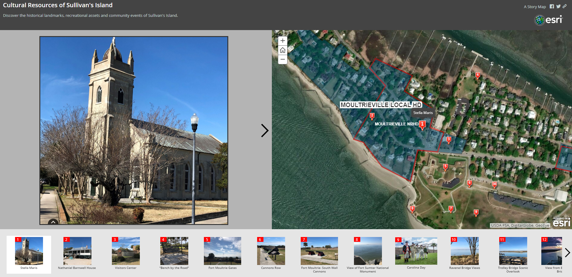 Cultural Resources Map Tour
Discover the historical landmarks, recreation assets and community events of Sullivan's Island.
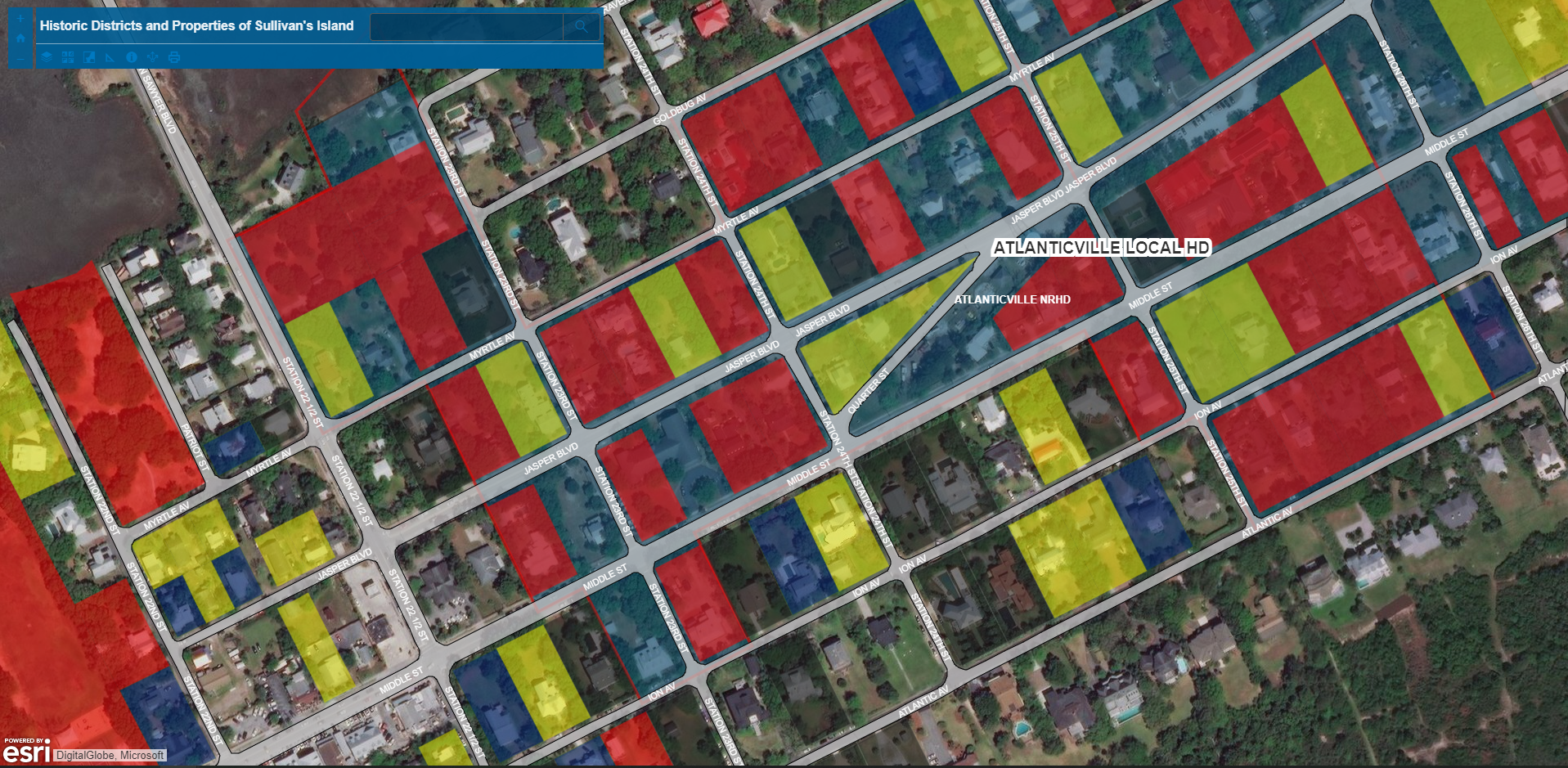 Historic Districts and Historic Resources
This map highlights local and National Register Historic Districts.
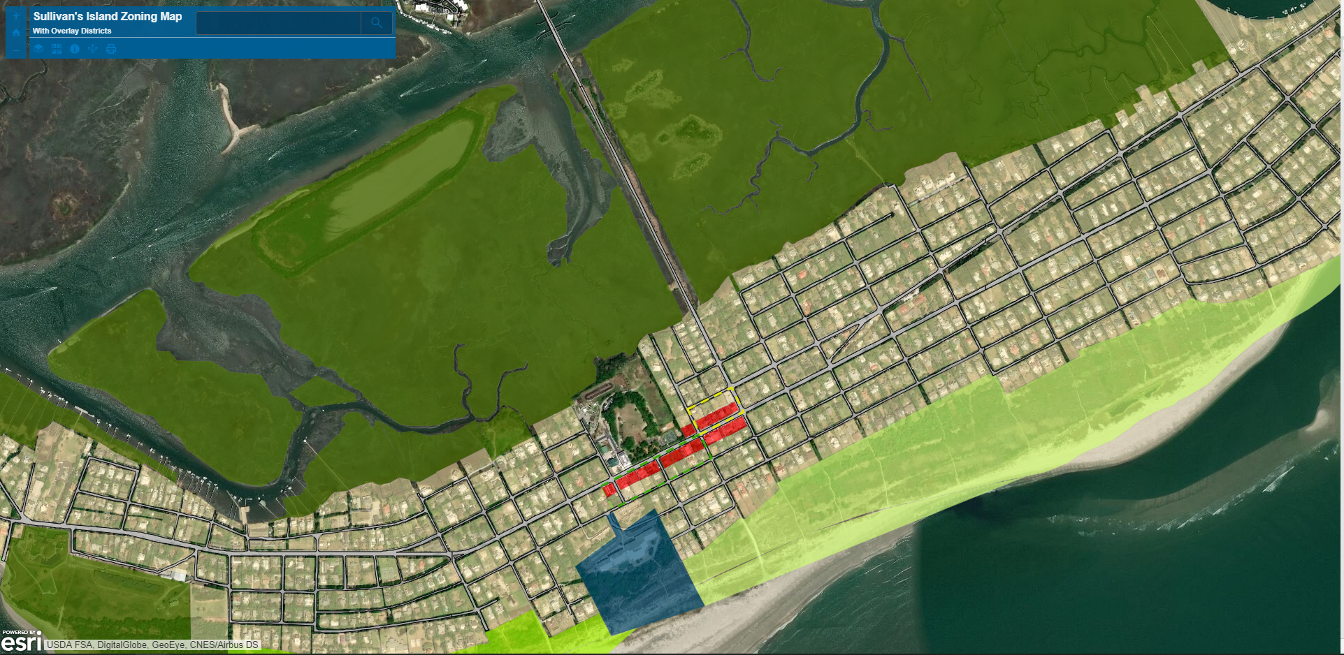
Zoning Map
This map identifies various zoning districts throughout the Island.
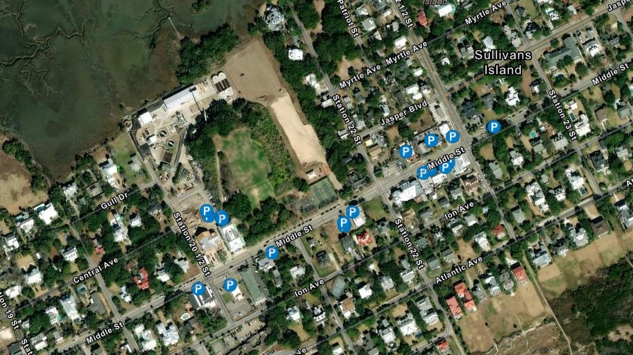 Commercial District ADA Parking Space Location Map
This map can help you identify handicap parking spaces in the business district.
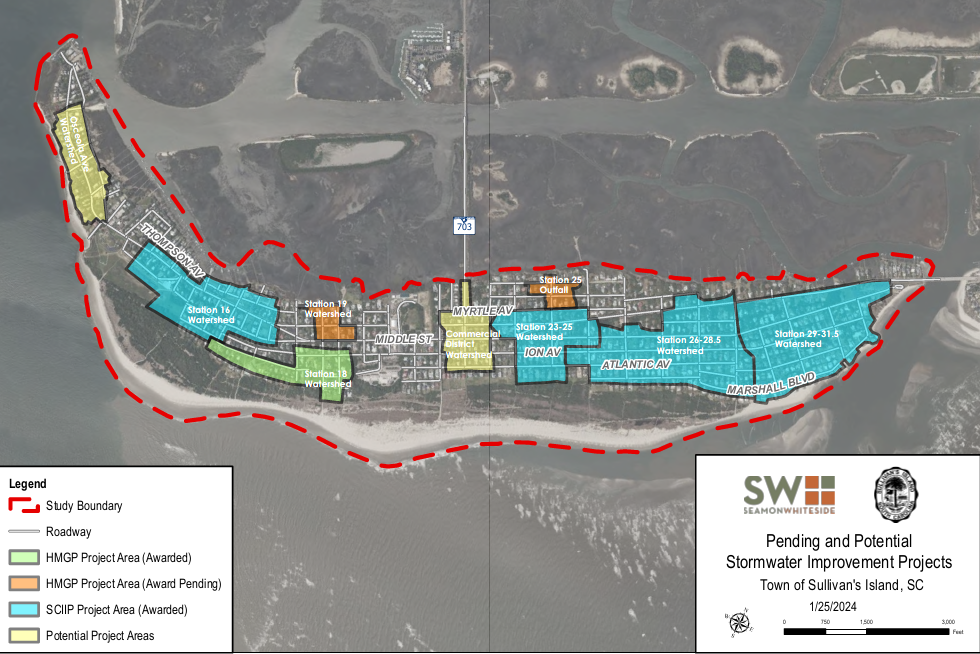
Pending and Potential Stormwater Improvement Projects
This map identifies various pending and potential stormwater improvement projects throughout the Island.